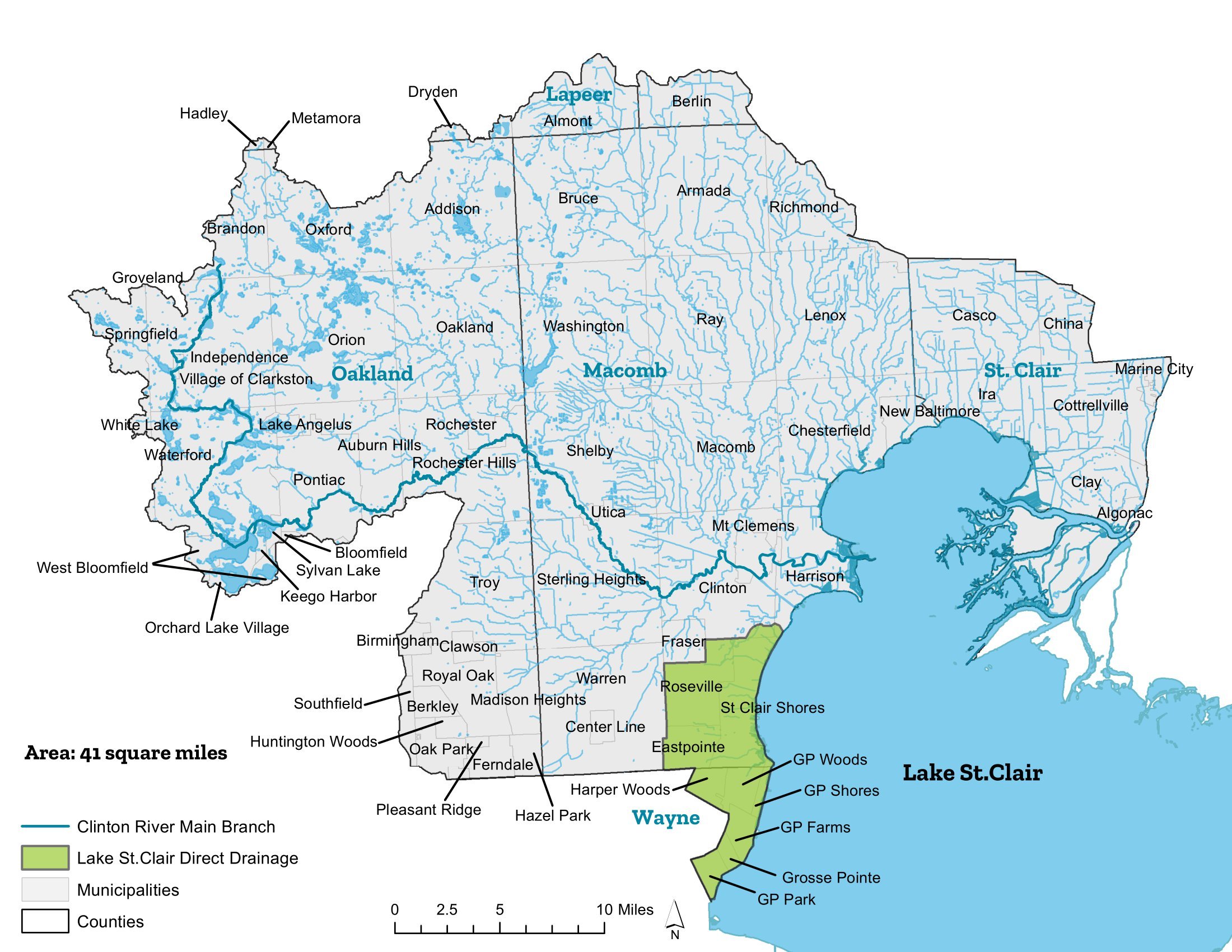

LAKE ST. CLAIR DIRECT DRAINAGE
The Lake St. Clair subwatershed management plan was put in place November 2006. Since that time (and before the plan’s approval), local governments, community leaders, citizens’ groups, businesses, and environmental organizations have worked together to implement their plan.
MUNICIPALITIES
Bruce Township
Clinton Township
Fraser
Harrison Township
Clinton Township
Eastpointe
Fraser
Grosse Pointe
Grosse Pointe Farms
Grosse Pointe Park
Grosse Pointe Shores
Grosse Pointe Woods
Harper Woods
Harrison Township
Lake Township
Roseville
St. Clair Shores
Macomb Township
Mt. Clemens
Ray Township
Village of Romeo
Shelby Township
Sterling Heights
Utica
Washington Township
AT A GLANCE
Area: Approx. 40 square miles
Counties: Macomb, Wayne
Primary Land Uses: Residential with some industrial/commercial
Open Water: 25 linear miles of open channel drains and 19 miles along the Lake St. Clair shore