
WaterTowns
WaterTowns® is a community-based placemaking initiative designed to help cities, towns and villages in the watershed leverage assets of the Clinton River and Lake St. Clair to help improve water quality and alleviate climate change impacts by promoting and implementing green infrastructure and advancing water-oriented community and recreation opportunities.
$80K +
In Mini-Grant
Funding
33
Current
WaterTowns
WHAT IS A DESIGNATED WATERTOWN?
A community elects to become a WaterTown and such communities:
Recognizes the potential of their water assets to attract and retain residents and businesses
Engages with the community in creating a vision or strategic plan for water access points
Develops and enhances water-oriented leisure and recreation amenities
Introduces green infrastructure into areas of redevelopment to improve water quality
Contributes to the social, economic, and environmental identities of communities.
CONNECTING PEOPLE TO THEIR WATERWAYS
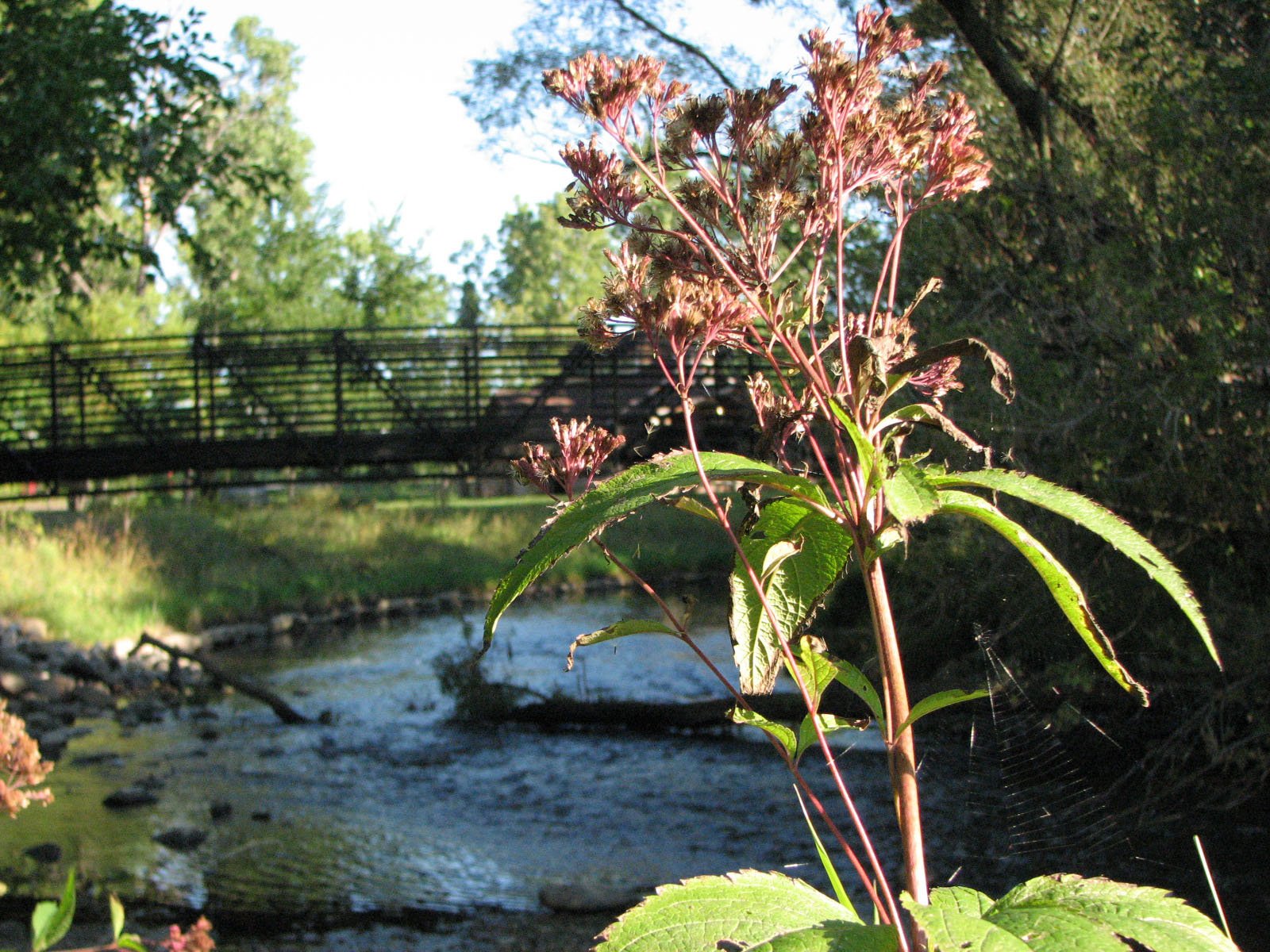
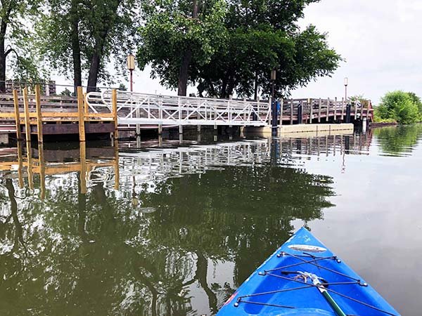
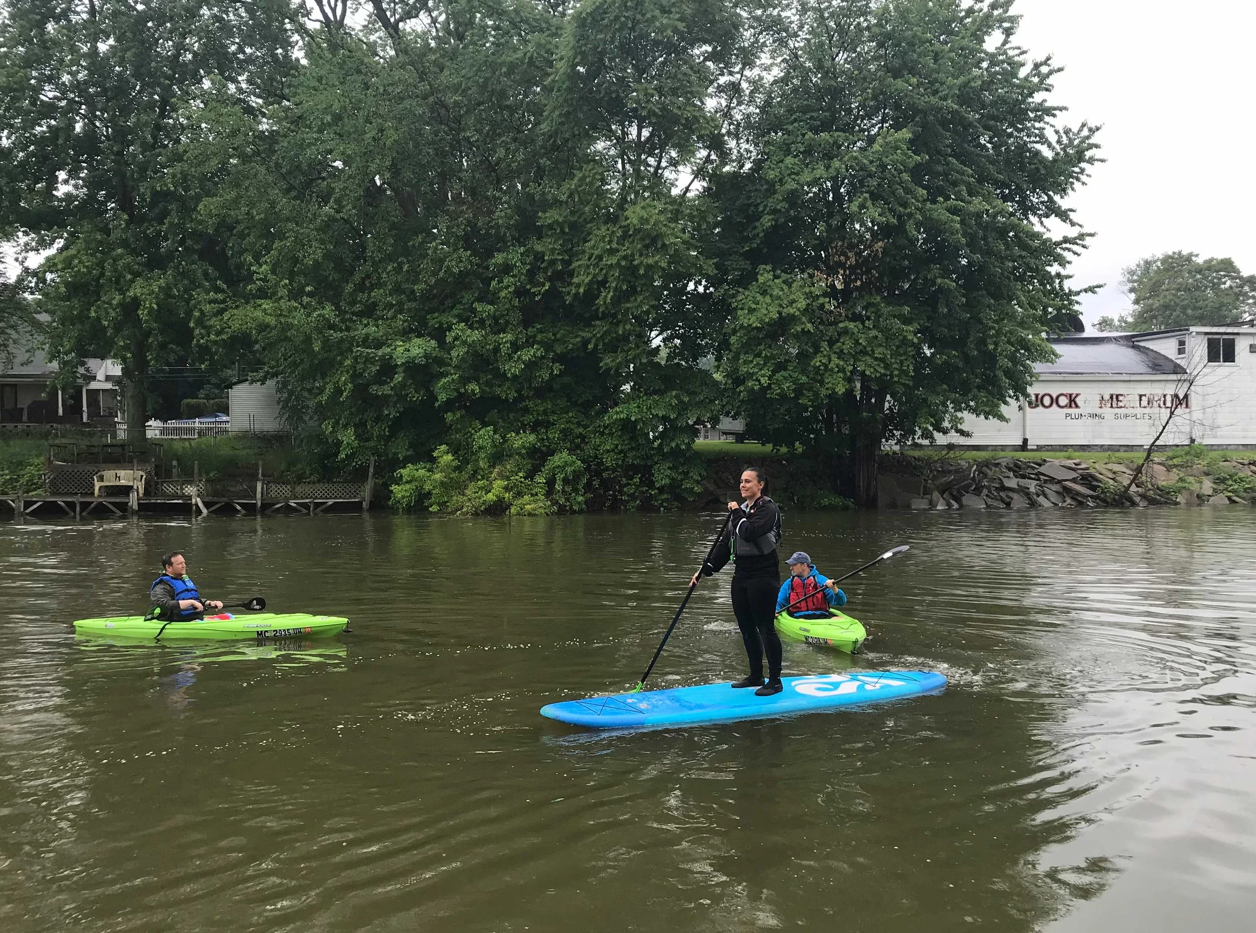
One of the goals of WaterTowns is to encourage public interactions with the river and improve accessibility for all river users, including those with disabilities. WaterTowns assisted with the installment of the first inclusive, universally accessible canoe and kayak launch on the Clinton River in MacArthur Park, in Downtown Mt. Clemens. There are now four additional universal launches at Innovation Hills, North Clinton River Park, Rotary Park, and George George Park.
RECREATION
To encourage public interactions with the river by improving accessibility and inclusivity for all water trail users.
PLACEMAKING
Contributing to the social, economic, and environmental identities of communities by creating stronger, more vibrant places along the Clinton River, Lake St. Clair, and throughout the entire watershed.
GREEN INFRASTRUCTURE
Enhancing watershed protection while improving public spaces by working with communities to construct, plan, and envision how to improve stormwater management using ecological features (e.g. amended soil and native vegetation) to achieve more natural hydrological functions.
CURRENT WATERTOWNS
Auburn Hills
Berkley
Birmingham
Center Line
Chesterfield
Clarkston
Clinton Township
Eastpointe
Ferndale
Harrison Township
Huntington woods
Huron Clinton Metropark Authority
Independence Township
Keego Harbor
Macomb Township
Madison Heights
Mount Clemens
New Baltimore
Oak Park
Oakland County
Orion Township
Pleasant Ridge
Pontiac
Rochester
Rochester Hills
Royal Oak
Shelby Township
St. Clair Shores
Sterling Heights
Troy
Utica
Village of Lake Orion
Warren
-
A hands-on approach to improving a neighborhood, city, or region, placemaking inspires people to collectively reimagine and reinvent public spaces as the heart of every community to create public spaces that promote people's health, happiness, and well-being. Placemaking is a multi-faceted approach to the planning, design, and management of public spaces and capitalizes on a local community's assets, vision, and potential.
-
Working like a natural forest by capturing and filtering runoff from rooftops, driveways, and other hard surfaces, rain gardens are a proven way of using landscaping to beautify and improve neighborhoods, reduce flooding, clean waterways, protect natural habitats, and save millions of dollars in pollution clean-up and massive utility construction projects. Rain gardens also improve air quality and provide habitat for bees, birds, butterflies, and other wildlife.
-
Permeable pavers are separated by joints filled with crushed aggregate, allowing the movement of air and water around the paving material. This paving system allows tree roots and the ground below to breathe, and when it rains, water enters the joints between the solid impervious pavers and flows through the paver system. As water runs through the aggregate, the pavers become a filter for urban pollutants and capture stormwater runoff.
-
By creating a natural treatment area, bioretention cells naturally remove contaminants from stormwater runoff by directing it from a parking lot into a depressed area consisting of a grass buffer strip, sand bed, ponding area, organic layer, and native plants. The runoff passes over or through a sand bed that slows the runoff's velocity and distributes it evenly along the length of the ponding area to be filtered and absorbed by the soil and plants.
-
Naturalized shorelines prevent shoreline erosion, slow and filter stormwater runoff, and provide biodiversity amongst plants, fish, and animals. Native plants on a riverbank or lake’s edge have densely interwoven root systems that are required to physically stabilize a shoreline. These deep, strong roots are specially designed to hold the soil in place while withstanding the energy of hitting waves, ice movement, and stormwater runoff.
BECOME A WATERTOWN
By building stronger connections to the water resources within their communities, CRWC helps municipalities enhance watershed protection while improving public spaces by assisting with green infrastructure, redevelopment opportunities, stormwater management, and improved access to recreation both on and near our lakes and rivers. To help make your city, town, or village a designated WaterTowns community, contact us today!

Many thanks to our friends at the Fred A. and Barbara M. Erb Family Foundation for their generous support of this program. Other funding partners include the MDEQ’s Nonpoint Source Pollution Program, the Ralph C. Wilson Foundation, the Office of the Great Lakes Coastal Zone Management Program, ITC Holdings, DTE Energy, and REI.