
The Clinton River Watershed
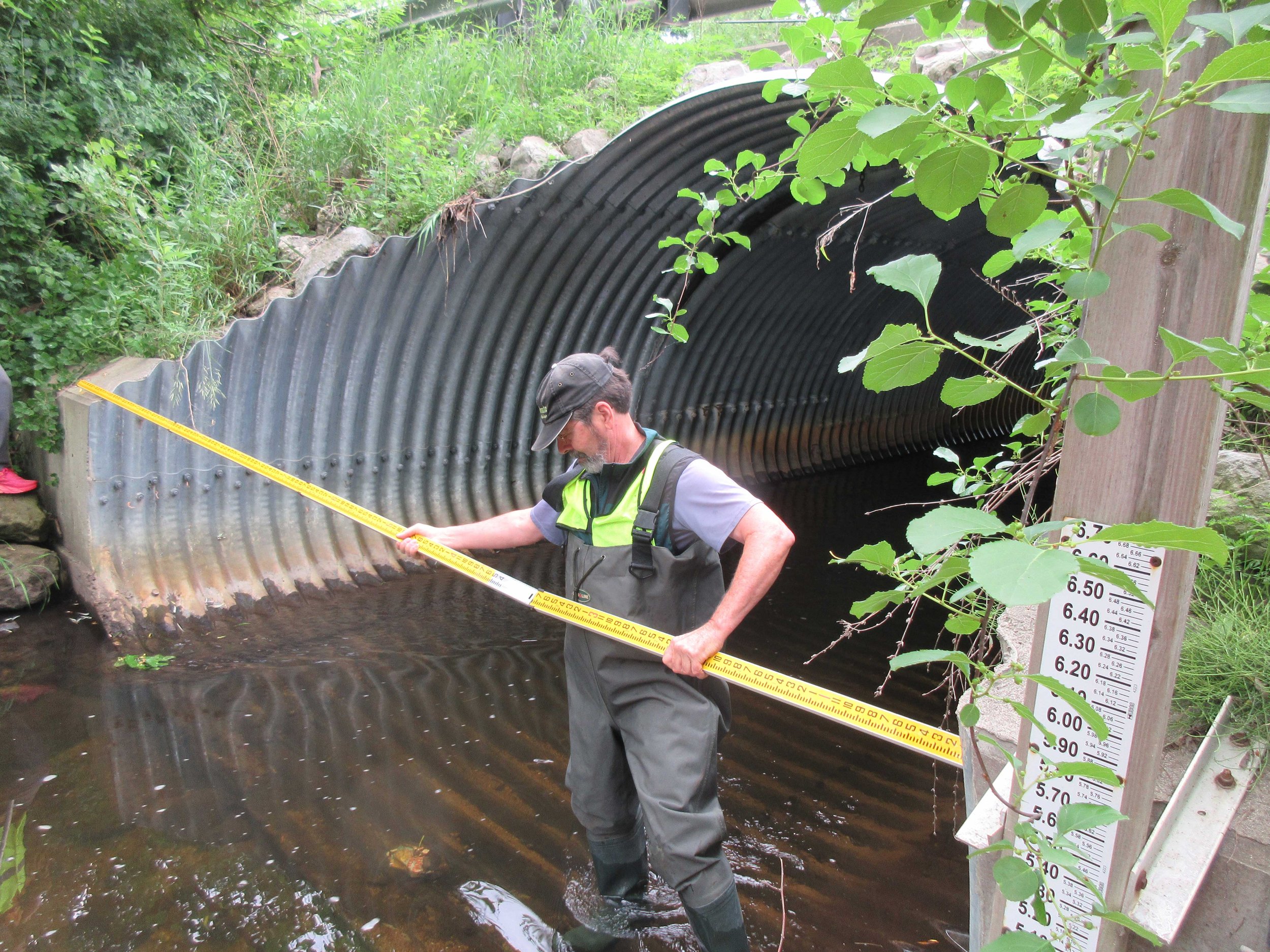
Home to heron, trout, mink, and other wildlife, the Clinton River watershed is comprised of thousands of lakes, ponds, wetlands, and hundreds of miles of clear, cold streams.
Our very own playground for fishing, paddling, swimming, and hiking, the Clinton River watershed is also a gateway to Lake St. Clair's boating paradise.
WHAT IS A WATERSHED?
A watershed is another word for a river basin, an area of land where water naturally collects and drains to one point. The Clinton River watershed is a 760 square mile area that is comprised of thousands of lakes, ponds, wetlands, marshes, and bogs – as well as coldwater tributaries, brooks and streams. These streams and rivers all drain into one common body of water, Lake St. Clair.
The most populated watershed in the state of Michigan, the Clinton River watershed is a large area that stretches through 63 communities and four counties, including Oakland, Macomb, Lapeer, and Wayne.

WHERE DOES THE CLINTON RIVER WATERSHED BEGIN AND END?
Aside from being the special place where we live, the Clinton River watershed is part of the Great Lakes Basin, one of the largest freshwater ecosystems in the world.
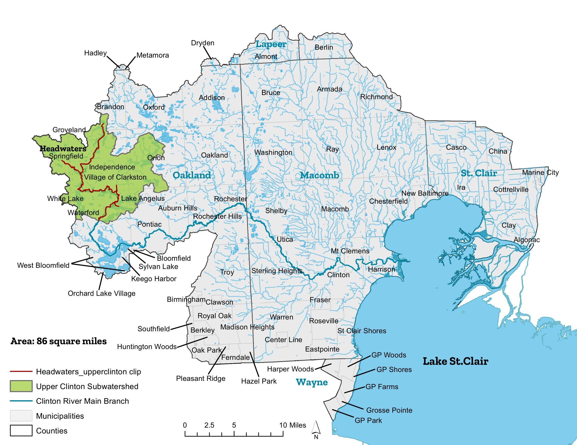
The Clinton River begins with small, fast-flowing tributaries. Tributaries are freshwater streams that feed into a larger stream or river, and these tributaries form the headwaters (the source) of a river.
The headwaters for the Main Branch of the Clinton River are found in the rural areas of northern Oakland County, northwest of Pontiac. Waters rise from the wetlands and coldwater tributaries from within Independence, Brandon, and Springfield Townships and flow in an easterly direction through many villages and townships including Clarkston, Waterford, West Bloomfield, Sylvan Lake, Lake Angelus, Pontiac, Auburn Hills, Rochester Hills, Rochester, Shelby Township, Utica, Sterling Heights, Clinton Township and Mount Clemens, to name a few.
Two important tributaries that feed into the Main Branch of the Clinton River are Paint Creek and Stony Creek. A favorite for trout anglers, Paint Creek is the only designated coldwater trout stream in Southeast Michigan. Paint Creek begins in the Oxford Township and Lake Orion area and stretches through Orion Township, Oakland Township and Rochester Hills before merging into the Main Branch of the Clinton River in Rochester.
Stony Creek begins in Addison Township from Lakeville Lake and continues through Bruce Township, Washington Township and Stony Creek Lake before merging into the Clinton River in Bloomer Park in Rochester Hills.
The Middle and North Branch of the Clinton River begin in the rural areas of Lapeer and Macomb County and flow south before both rivers merge into the Main Branch of the Clinton River in Clinton Township, for which the township was named.
The Middle Branch of the Clinton River is wedged between the North Branch and Stony Creek and begins in Washington Township, flowing easterly through Shelby, Macomb, and Clinton Township.
The North Branch of the Clinton River begins in Almont and flows south through Bruce, Armada, Ray, and Macomb Township before merging into the Clinton River near Mt. Clemens.
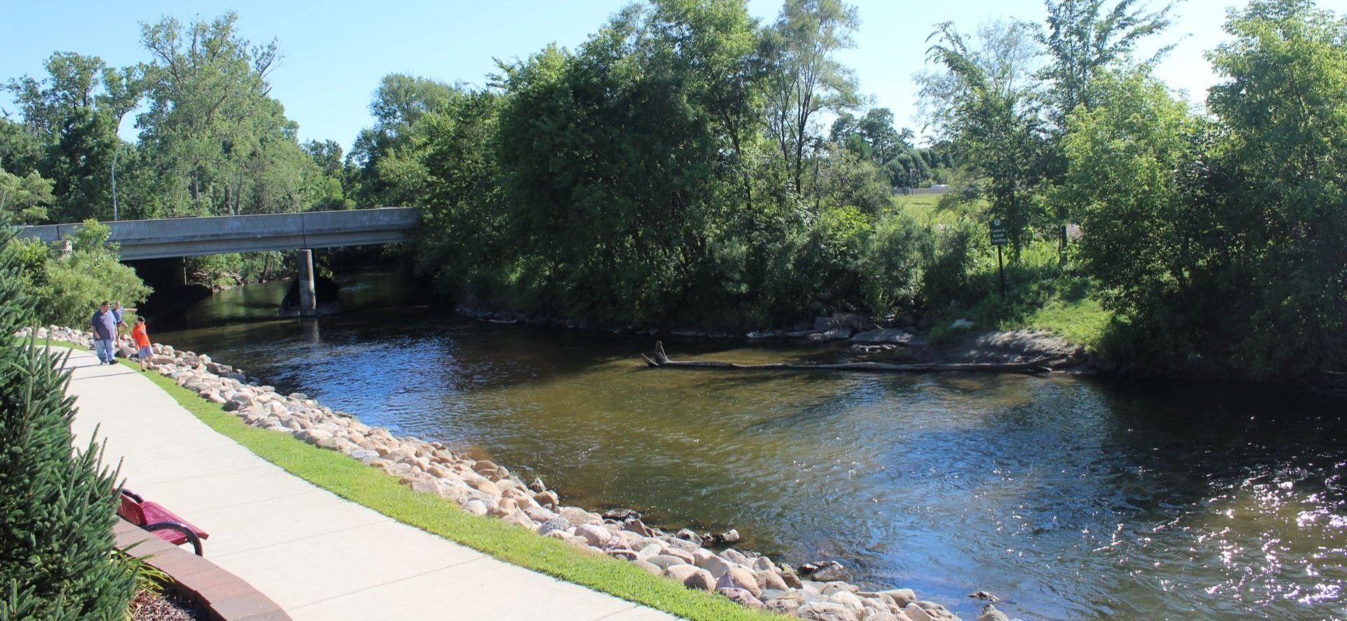
The Clinton River travels for 81.5 miles through marshes, forests, farmland, cities, and parks. As the river makes its journey, the Clinton River flows through more suburban and urbanized areas before reaching Lake St. Clair in Harrison Township.
The Red Run flows through the most heavily urbanized portion of the Clinton River Watershed, to the south. It begins in Madison Heights, combining with drains to the northwest and flowing eastwards through Warren and Sterling Heights before meeting the Clinton River in Clinton Township.
Lake St. Clair is the 15th largest lake in the United States with over 430 square miles of freshwater and is sometimes affectionately referred to as the 6th Great Lake. Lake St. Clair is home to the largest freshwater delta in the Great Lakes Basin --the St. Clair River Delta--which has a major impact on the lake’s water quality and clarity. Essential to the Saint Lawrence Seaway shipping route, Lake St. Clair connects Lake Huron to Lake Erie and to oceangoing vessels traveling to the Atlantic Ocean.
The Clinton River, its watershed, and Lake St. Clair are a valuable freshwater resource that not only provide important ecological functions but also provide the region with many important uses, including water-oriented towns, tourism, diverse wildlife habitat, boating, fishing, and many other recreational activities.
SUBWATERSHED MANAGEMENT PLANS
Subwatershed management plans provide a framework for communities to address various issues related to water quality collaboratively. For example, subwatershed management plans include language about building practices, land use planning, public education, and other relevant topics. Each community and organization represents one entity essential to the success of watershed management. Strategic planning done at a local level will have great influence on the future of the Clinton River watershed and beyond. These plans serve as a map to that future.
-

CLINTON MAIN
-

CLINTON RIVER EAST
-
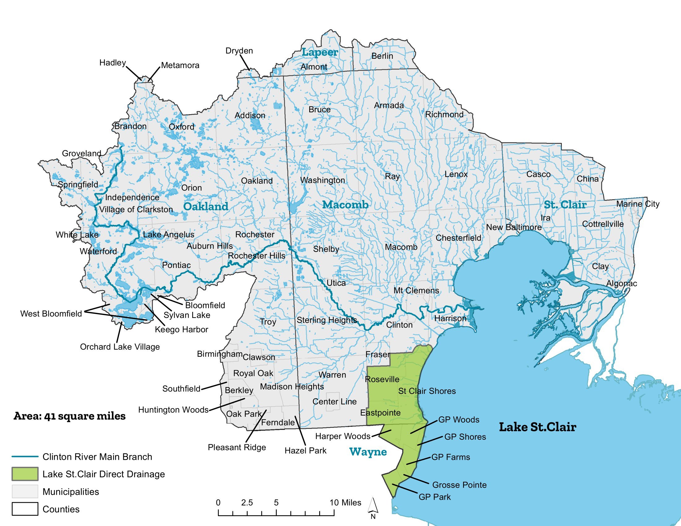
LAKE ST. CLAIR DIRECT DRAINAGE
-

NORTH BRANCH
-

RED RUN
-

STONY/PAINT CREEK
-
UPPER CLINTON